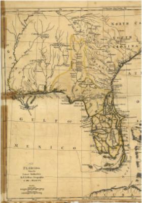
This map was originally featured in William Roberts' "An Account of the First Discovery, and Natural History of Florida," published in 1763.
Jefferys used inforamtion found from various French and Spanish sources.
Note the Creek Indian boundaries, as described by Jefferys. A number of prominent Creek towns are
listed.
Various trade routes centered on established trails and waterways. The early deerskin traders relied heavily on this network of
towns and villages.
Although later maps included much more detailed topographical renderings, this Thomas Jefferys maps
is important to the study of the fur trade in the southeast in the late 18th century because the distribution
of indegenous groups began to change as a result of the American Revolution, and the changing nature
of their culture.
Jeffrey's Map, 1763


