How do you con an honorable indigenous people with no real concept of individual land ownership out of their tribal territory?
Credit.
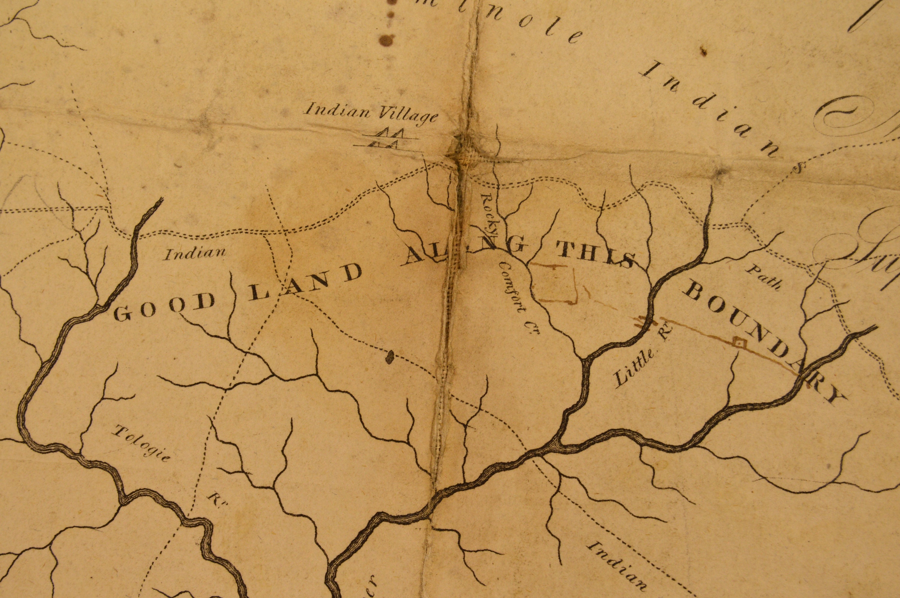
As the tribe settles and adopts more European ways, sell them manufactured cloth, iron goods, glass, and firearms on credit. After a couple of decades of this you can run up quite a bill. To settle up, as the Seminole and Creek tribes around the Apalachicola River were ready to do in the early 1800’s the tribes agreed to give up approximately 1.4 million acres (they thought it was 1.2 million) located between the Apalachicola and Wakulla rivers. This is now all of the counties of Franklin and Liberty, as well as a large part of Gadsden, Leon and Wakulla counties in North West Florida.
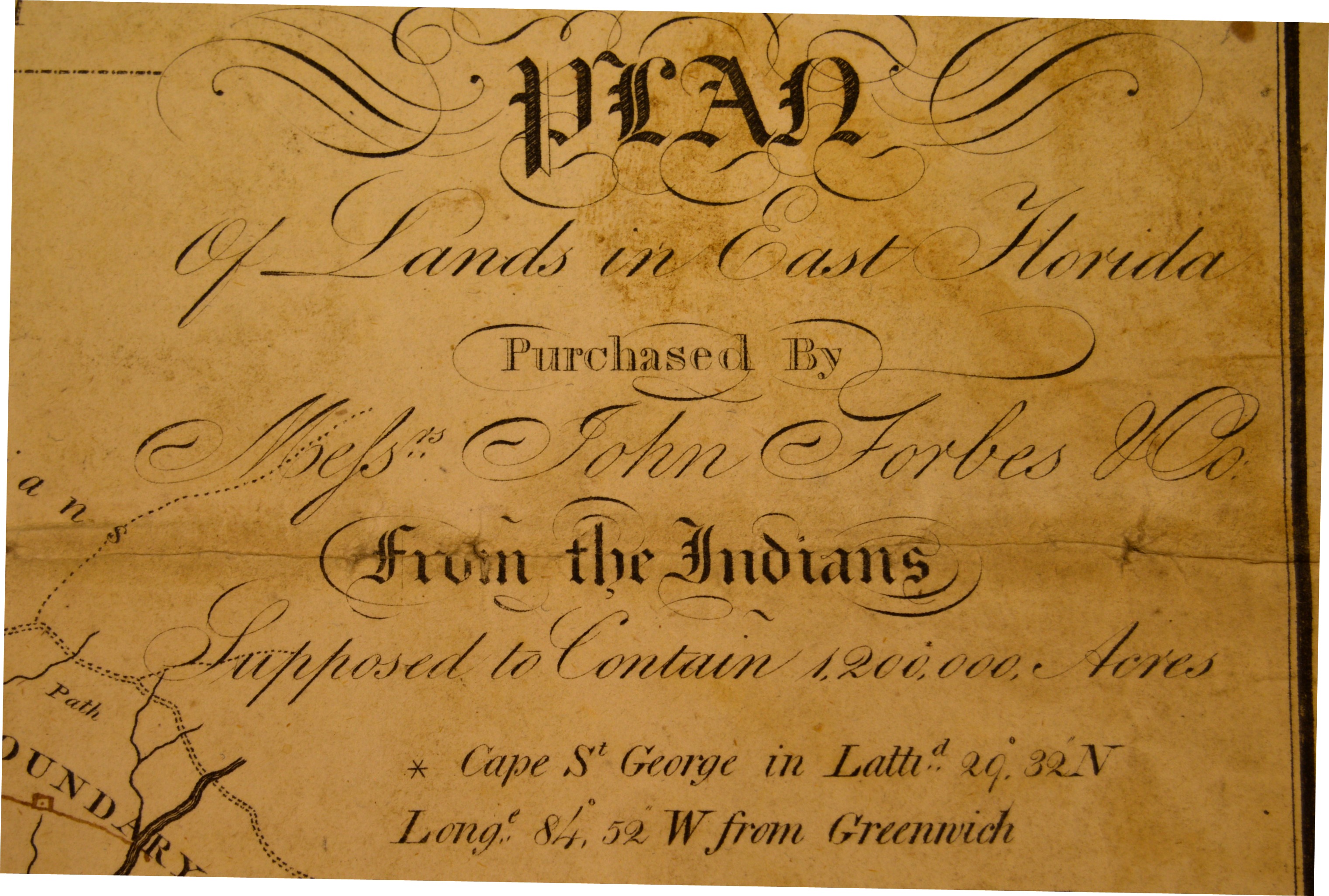
This land deal, called the Forbes Grant, generated years of litigation (it wasn’t finally settled until 1835) as well as a map. Now in the collection of the Library of Florida History in Brevard County, that map offers the first detailed look at the Apalachicola River as it flowed in 1805.

Along with Indian trails and villages, forts and streams along the entire 167 mile watershed in Florida, it shows Forbes Island, awarded personally to John Forbes, the owner of the trading operation collecting the debt. Archeologists and historians today use this same map to locate those vanished villages.
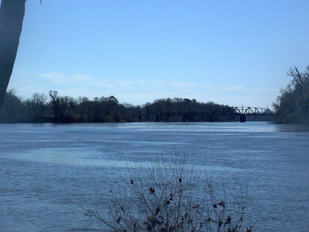
The Apalachicola River is the second longest in Florida after the St. John’s, and has just as long a history. It was a major food source and transportation route for the indigenous groups long before the Europeans arrived. The Spanish knew it well, but it wasn’t until the English took over in 1763 that it became a dividing line. It runs roughly north and south, so it was an easy way to divide Florida into two English colonies, West Florida, which ran to the Mississippi River, and East Florida, basically everything else.
The Apalachicola starts near the border between Florida and Georgia, where the Chattahoochee and Flint rivers merge. Combined, this is called the A. C. F. watershed, with its headwaters in the foot hills of the Appalachian Mountains, in the Chattahoochee National Forest in north east Georgia almost at the South Carolina border.
As it was for the Native Americans, the Apalachicola River was a major transportation resource for the early pioneers, and an easy way to get people in and agricultural products out of the interior pan-handle of Florida. At first there were flat boats to transport cotton downstream. Upstream was more of a chore, but as early as the 1820’s the flat-boat technology was replaced with steam technology. In turn, in the 1830’s the steam boats were displaced by the locomotives of the St. Josephs & Lake Wimico Line rail road, running along the river.
Cotton and agriculture were the center of the economy until the late 19th Century, when logging took over. Massive amounts of Florida wood was shipped down the river to the Gulf, and then all over the world.
This map is the earliest detailed survey of the river, but it only shows its historic route. Even to the unpracticed eye, the meandering path gives a hint of the river’s variability and the extent of its flood plain. This tendency to flood was an annoyance to the early settlers who wanted to be close to the river. As settlements matured, it was more than an annoyance.
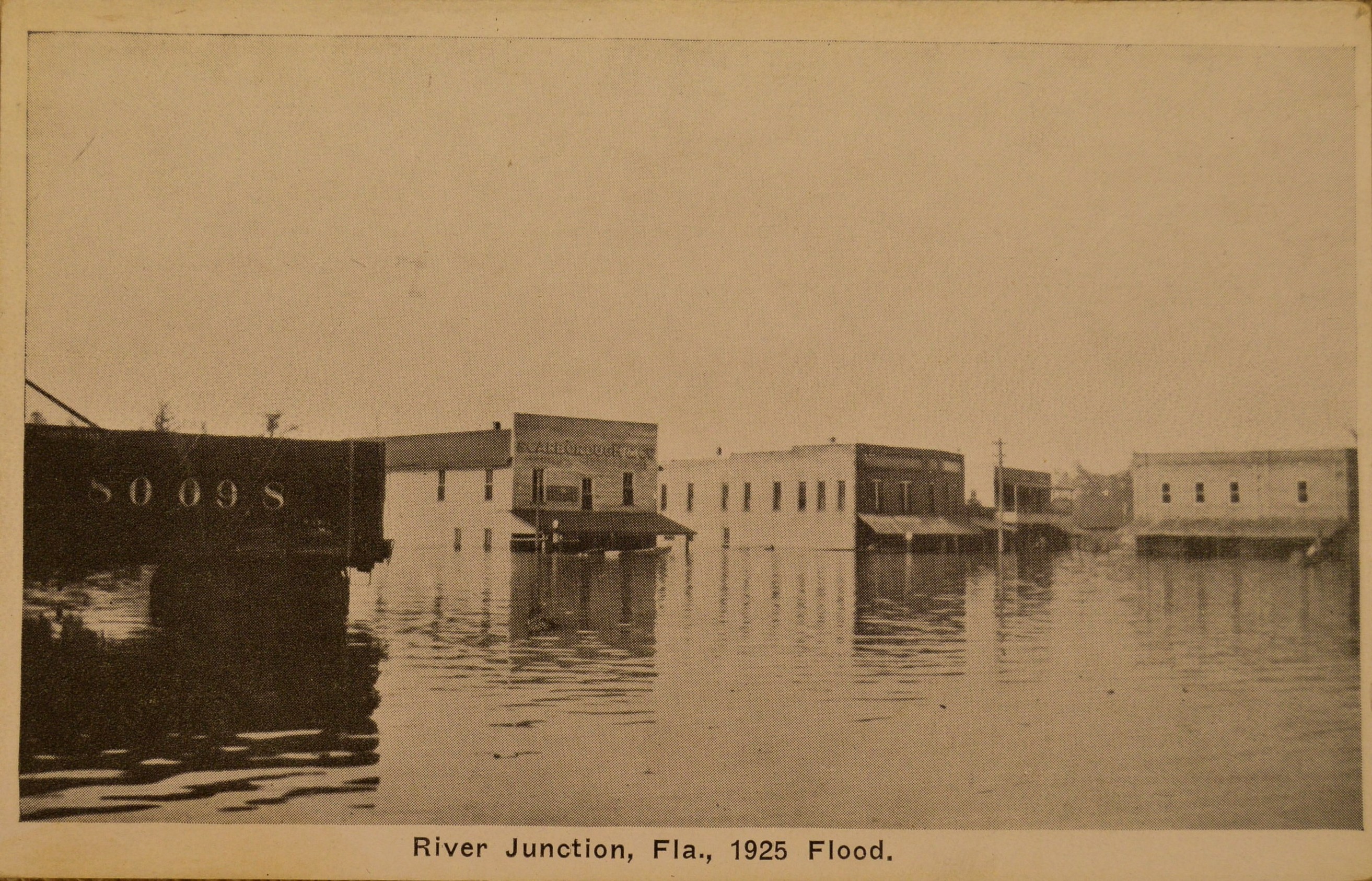
Post cards in the Library’s collection show a 1925 flood in River Junction, now part of the town of Chattahoochee near the beginning of the Apalachicola River.
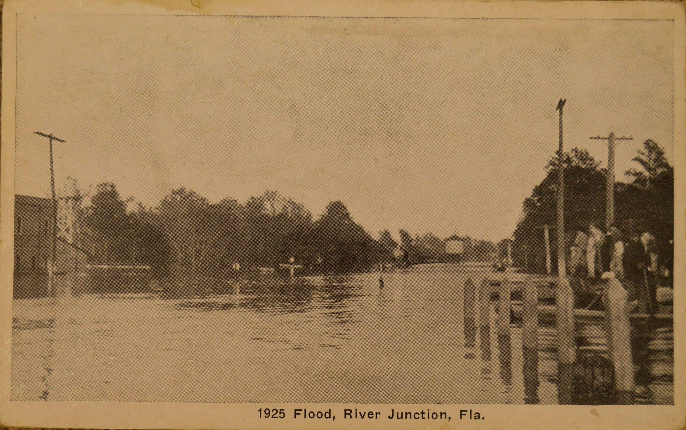
One of the cards says on the back “a boat came right into the drug store where we bought this card.”
The river, in fact the whole A. C. F. basin, is still making history. It has been at the center of decades of legal battles between Florida and Georgia over water use, and in 2016 the Apalachicola was named “most endangered river in America” by a national environmental group.