The land your home sits on was not always a building site. In fact, especially in Florida, it might not even have been land. But former swamp, former citrus grove, former cow pasture or former sand dune, that site has a story to tell. To tell its story the site first needs a name, and nowadays we call that name the property’s “Legal Description.”
In Florida, the legal description comes from the Public Land Survey System (PLSS), basically a huge grid of surveyed land covering much of the United States outside the original colonies. The system, originally proposed by... who else ...Thomas Jefferson, was created by the Land Ordinance of 1785 to facilitate sale and settlement of land ceded to the country after the Revolution.
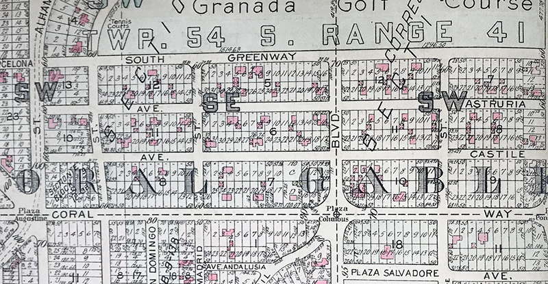
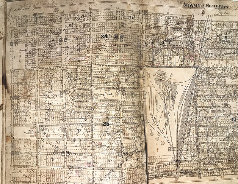
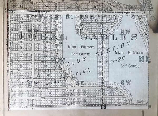
The land was cut up into townships, and ranges and blocks and so on, right down to the individual lot number. The results were drawn on maps, called plats, like this one. That is how the land you live on got its name. You can discover its story by looking at these plat maps and seeing how they changed over the decades.
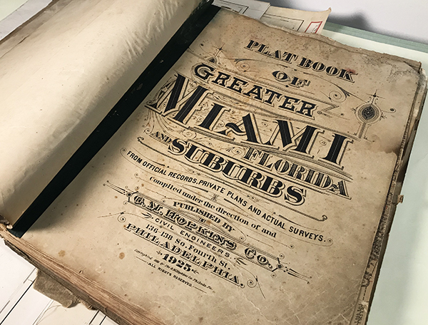
The stories of some Florida lands are told in books like this one published in 1925, a recent addition to the collection at the Library of Florida History in Cocoa.
The pages offer a detailed look at Miami at the height of its post WWI growth. The city was the epicenter of Florida’s land boom. Property prices sky rocketed and the economy heated up as construction of homes and businesses raced to keep up with demand.
To keep up with the changes, rather than print a whole new book the publisher, G.M. Hopkins Co. out of Philadelphia, a nationwide firm that published maps for the whole country between 1865 and the 1940s, would send in a representative to glue updates on the pages. The white papers, or the remaining glue stains where some have fallen off over the years, testify to the speed of development in those heady days. It seemed unstoppable. Then a boat tipped over.
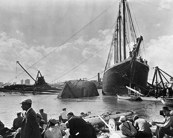
Courtesy Florida Memory
One day in January, 1926 the 250 foot steel hulled schooner Prinz Valdemar was being towed into Miami harbor. It capsized in the mouth of the turning basin. It took months to get it out, but meanwhile no marine traffic could get into the port. That meant building supplies could not be brought in to sustain the growth. The railroad could not keep up. The boom sputtered. Then in September, 1926, along came “The Great Miami Hurricane.” The name says it all.
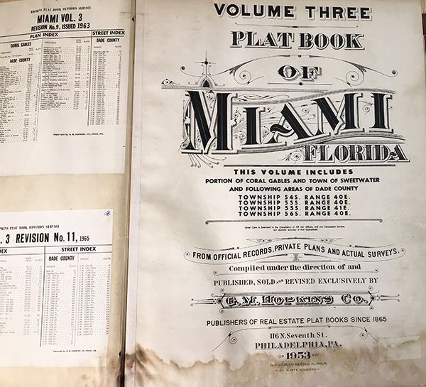
Of course Miami came back, and this 1953 edition (updated through the early 60s) tells the story of the post WWII growth.
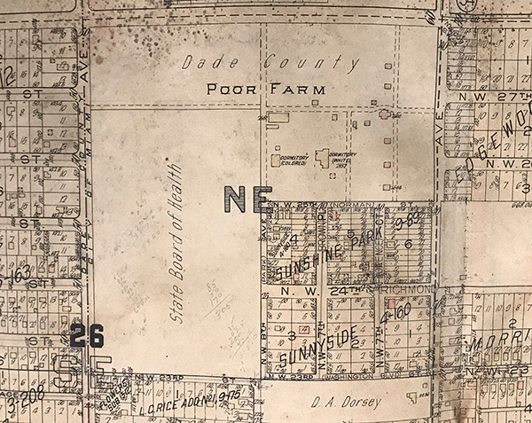
The stories go beyond distribution of land and the construction booms. They show elements of Miami you might not equate with the city, such as dairy farms and, in the midst of all that growth and riches, the county poor farm.
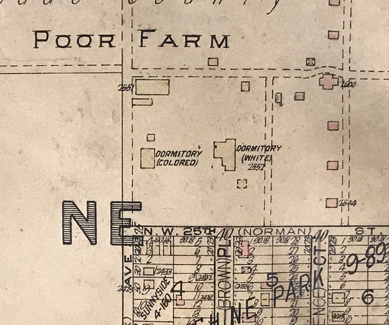
Looking even closer, you see evidence of the culture of the times, too; segregated housing even with the poorest of the poor.

These interesting and obviously well-worn books recently came to the library from Florida Historical Society member Jack Rabun, seen here in a 2018 photo. Jack knows their story well, in fact, he actually lived it.
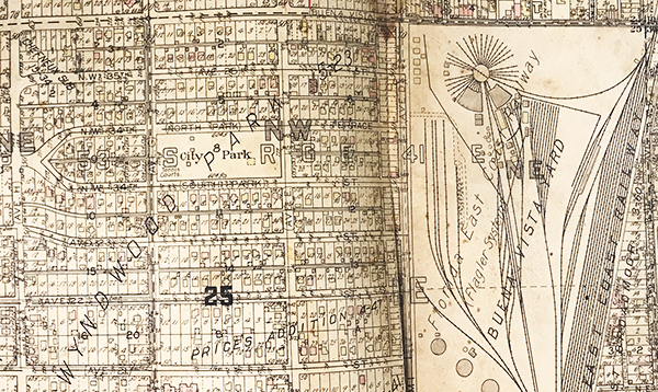
Jack’s family came to Miami from Georgia in the 1940 s, and he grew up in the Wyndwood Park neighborhood, north of downtown Miami. It is a neighborhood he describes as ‘on the other side of the tracks.’ The map shows that to be literally true, depending on where you are standing.
add(image 11 young Jack)
Jack grew up to be, you guessed it, a surveyor for the city, documenting the changes found in plat books. He also collected stories about the city, its people and culture. You could say he “has a million of them.” That’s almost as many as his map books.